# GDAL commands via OSGeo4W Shell
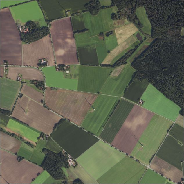
>gdalinfo /vsicurl/https://dop20-rgbi.s3.eu-de.cloud-object-storage.appdomain.cloud/324905842/2024-09-05/dop20rgbi_32_490_5842_2_ni_2024-09-05.tif
Driver: GTiff/GeoTIFF
Files: /vsicurl/https://dop20-rgbi.s3.eu-de.cloud-object-storage.appdomain.cloud/324905842/2024-09-05/dop20rgbi_32_490_5842_2_ni_2024-09-05.tif
Size is 10000, 10000
Coordinate System is:
PROJCRS["ETRS89 / UTM zone 32N",
BASEGEOGCRS["ETRS89",
ENSEMBLE["European Terrestrial Reference System 1989 ensemble",
MEMBER["European Terrestrial Reference Frame 1989"],
MEMBER["European Terrestrial Reference Frame 1990"],
MEMBER["European Terrestrial Reference Frame 1991"],
MEMBER["European Terrestrial Reference Frame 1992"],
MEMBER["European Terrestrial Reference Frame 1993"],
MEMBER["European Terrestrial Reference Frame 1994"],
MEMBER["European Terrestrial Reference Frame 1996"],
MEMBER["European Terrestrial Reference Frame 1997"],
MEMBER["European Terrestrial Reference Frame 2000"],
MEMBER["European Terrestrial Reference Frame 2005"],
MEMBER["European Terrestrial Reference Frame 2014"],
MEMBER["European Terrestrial Reference Frame 2020"],
ELLIPSOID["GRS 1980",6378137,298.257222101,
LENGTHUNIT["metre",1]],
ENSEMBLEACCURACY[0.1]],
PRIMEM["Greenwich",0,
ANGLEUNIT["degree",0.0174532925199433]],
ID["EPSG",4258]],
CONVERSION["UTM zone 32N",
METHOD["Transverse Mercator",
ID["EPSG",9807]],
PARAMETER["Latitude of natural origin",0,
ANGLEUNIT["degree",0.0174532925199433],
ID["EPSG",8801]],
PARAMETER["Longitude of natural origin",9,
ANGLEUNIT["degree",0.0174532925199433],
ID["EPSG",8802]],
PARAMETER["Scale factor at natural origin",0.9996,
SCALEUNIT["unity",1],
ID["EPSG",8805]],
PARAMETER["False easting",500000,
LENGTHUNIT["metre",1],
ID["EPSG",8806]],
PARAMETER["False northing",0,
LENGTHUNIT["metre",1],
ID["EPSG",8807]]],
CS[Cartesian,2],
AXIS["(E)",east,
ORDER[1],
LENGTHUNIT["metre",1]],
AXIS["(N)",north,
ORDER[2],
LENGTHUNIT["metre",1]],
USAGE[
SCOPE["Engineering survey, topographic mapping."],
AREA["Europe between 6┬░E and 12┬░E: Austria; Denmark - onshore and offshore; Germany - onshore and offshore; Italy - onshore and offshore; Norway including Svalbard - onshore and offshore; Spain - offshore."],
BBOX[36.53,6,84.01,12.01]],
USAGE[
SCOPE["Pan-European conformal mapping at scales larger than 1:500,000."],
AREA["Europe between 6┬░E and 12┬░E and approximately 36┬░30'N to 84┬░N."],
BBOX[36.53,6,84.01,12.01]],
ID["EPSG",25832]]
Data axis to CRS axis mapping: 1,2
Origin = (490000.000000000000000,5844000.000000000000000)
Pixel Size = (0.200000000000000,-0.200000000000000)
Metadata:
OVR_RESAMPLING_ALG=BILINEAR
AREA_OR_POINT=Area
Image Structure Metadata:
LAYOUT=COG
INTERLEAVE=PIXEL
Corner Coordinates:
Upper Left ( 490000.000, 5844000.000) ( 8d51' 6.70"E, 52d44'44.76"N)
Lower Left ( 490000.000, 5842000.000) ( 8d51' 6.92"E, 52d43'40.03"N)
Upper Right ( 492000.000, 5844000.000) ( 8d52'53.36"E, 52d44'44.88"N)
Lower Right ( 492000.000, 5842000.000) ( 8d52'53.53"E, 52d43'40.15"N)
Center ( 491000.000, 5843000.000) ( 8d52' 0.13"E, 52d44'12.46"N)
Band 1 Block=512x512 Type=Byte, ColorInterp=Red
NoData Value=0
Overviews: 5000x5000, 2500x2500, 1250x1250, 625x625, 313x313
Band 2 Block=512x512 Type=Byte, ColorInterp=Green
NoData Value=0
Overviews: 5000x5000, 2500x2500, 1250x1250, 625x625, 313x313
Band 3 Block=512x512 Type=Byte, ColorInterp=Blue
NoData Value=0
Overviews: 5000x5000, 2500x2500, 1250x1250, 625x625, 313x313
Band 4 Block=512x512 Type=Byte, ColorInterp=Undefined
NoData Value=0
Overviews: 5000x5000, 2500x2500, 1250x1250, 625x625, 313x313